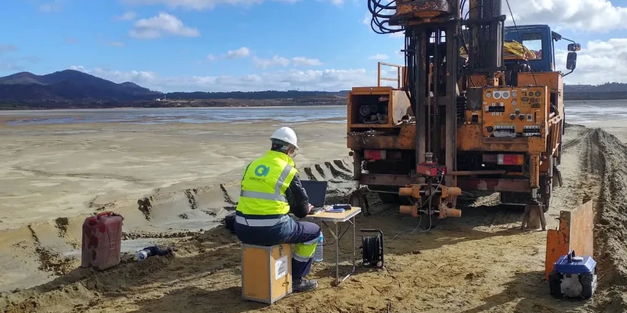
ASCE 7-22 and the International Building Code require a site-specific ground motion analysis when a project site is underlain by soils vulnerable to amplification or liquefaction. In Corpus Christi, where the subsurface profile often consists of loose Pleistocene fluvial sands and high-plasticity Beaumont Formation clays sitting just above the water table, a generic code-based approach can significantly misrepresent the true seismic demand. Our team has been running microzonation campaigns up and down the Texas Gulf Coast for years, and we understand the local stratigraphy well enough to know that a single Vs30 measurement rarely tells the full story here. We combine MASW testing with deep SPT borings and laboratory cyclic triaxial data to build a defensible, three-dimensional model of how the ground will actually move during a design-level earthquake.
A one-size-fits-all Site Class D designation can hide a factor of two in spectral acceleration across a single subdivision in Corpus Christi.
Local considerations
The coastal plain setting of Corpus Christi creates a dual seismic hazard that standard desktop studies miss. First, the shallow groundwater, often within 5 to 8 feet of grade, means a large volume of the Holocene and upper Pleistocene sand sheet is saturated and loose, making it susceptible to cyclic softening and liquefaction even at a moderate PGA of 0.08g to 0.12g. Second, the stiff Beaumont clays that cap much of the city are not rigid: they amplify short-period ground motion and can develop excess pore pressure at depth under prolonged shaking. A microzonation that only looks at Vs30 and ignores the pore pressure generation potential of the full soil column is dangerously incomplete for critical infrastructure like the port facilities, the Harbor Bridge approach structures, and the regional hospital expansions currently underway. We run fully coupled effective stress site response analyses in DEEPSOIL v7 to quantify both spectral amplification and settlement from post-shaking reconsolidation.
Frequently asked questions
What does a seismic microzonation study cost for a typical commercial project in Corpus Christi?
For a standard commercial building on a 2- to 5-acre lot, a site-specific microzonation study in the Corpus Christi area typically ranges from US$3,600 to US$15,220. The final cost depends on the number of geophysical lines, the depth of investigation, and the number of laboratory cyclic tests required to characterize the Beaumont clay and underlying sand units. A simple Vs30 determination is at the low end; a full nonlinear site response analysis with three-component time histories is at the high end.
Do we still need a microzonation if the USGS map shows our site as Site Class C?
The USGS Vs30 map is a regional proxy based on topographic slope, not a measured value. In the flat coastal plain of Corpus Christi, the proxy often misclassifies a site by a full class because it cannot distinguish between a stiff clay terrace and a loose sand-filled channel. If you are designing a structure in Risk Category II or higher and the mapped Vs30 places you within 50 m/s of a Site Class boundary, the IBC requires a measured Vs30. We recommend measuring it directly with MASW rather than gambling on a default classification that could change your design base shear by 30% or more.
How long does the field work and reporting take?
A typical microzonation project in Corpus Christi takes three to four weeks from mobilization to final report. The field work itself is usually two to three days for the geophysical survey and one day for the calibration borehole. The bulk of the time is in the laboratory testing of the Shelby tube samples and the iterative site response modeling. We can deliver a preliminary site class letter within 72 hours of completing the field work if the project schedule requires an early foundation design release.